Teotihuacan
Teotihuacan is one of those big-deal ruins in Mexico. Once one of the largest cities in the world, today only the ruins remain about 25 miles North of Mexico City. UNESCO named this ancient city a World Heritage site in 1987, and it's now the most visited archaeological site in Mexico.
Almost all of our ruin visits so far have been Mayan cities. Teotihuacan isn't Mayan, or even Aztec -- the predominant influence in central Mexico. Amazingly, archaeologists don't know who founded Teotihuacan; there are theories but the subject actively debated today. I find this fascinating because it's
such a big site and was so advanced for its time period, and we know so much about comparable ruins.
When planning to visit Teotihuacan we had to make a choice: book an organized tour, or take public transportation. We went with public transportation because it's substantially cheaper, and I wanted to adventure on the notorious Mexico City subway.
The Subway
We walked the one block from our hostel to the Insurgentes subway station, just after peak rush hour on a weekday morning. After figuring out the tickets, we boarded a train car that actually wasn't very different from New York's. More plastic and less metal, but these trains move fast! It wasn't so much that the max speed was faster, but that the trains do not spend much time in the station: the doors open, close and the train immediately takes off.
Those familiar with the NYC subway system know that the doors are constantly closing and reopening in the station, wasting dozens of seconds at every stop, and that the trains frequently stop on the tracks for no apparent reason. This was absent in the Mexico City subway system, and it really made me appreciate how those little delays add up.
 |
| An underground passage in the Mexico City metro |
 |
| A train passes us at our transfer station |
I'd listened to a
podcast about the '68 Olympics hosted in Mexico City, and learned a bit about the history of the subway system (it's a worthwhile podcast if that sounds interesting at all to you). Many burgeoning cities use their first Olympics as a chance to debut themselves as open to international tourism and investment; Mexico City in 1968 was no exception.
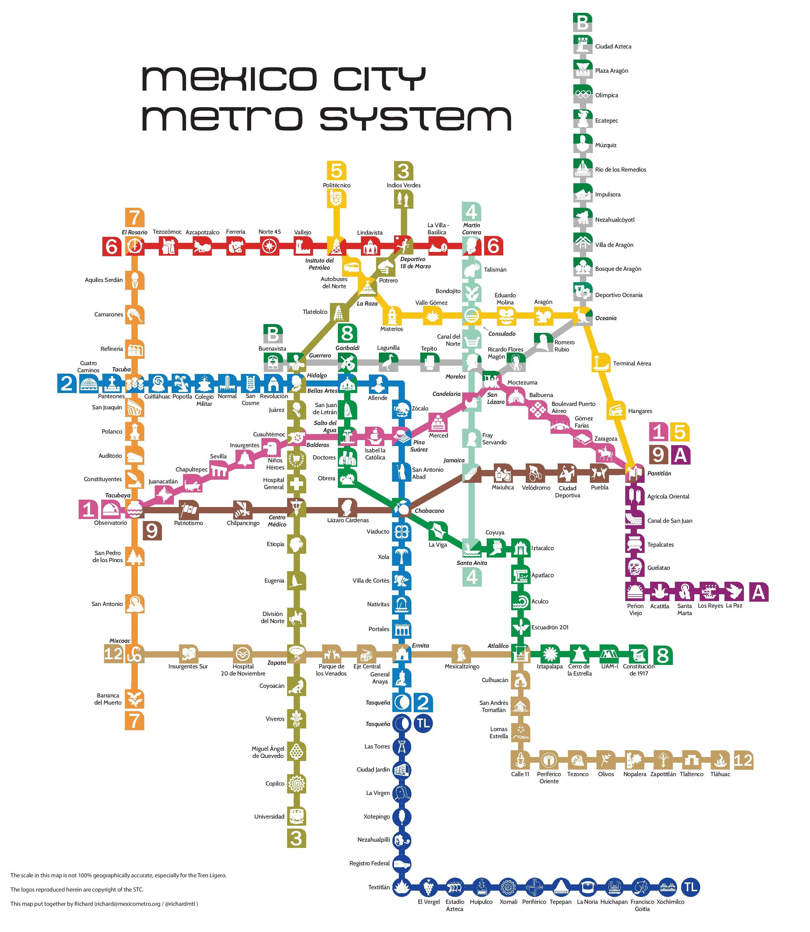
They controversially hired a foreign designer to produce the event signs and official advertisements for the games: Lance Wyman. He famously developed colorful, clear icons for each sporting event and reduced the need for writing signs in multiple languages to accommodate thousands of visitors. As the opening of the subway system ran behind, authorities asked Wyman to stay on and design the subway map as well. That map design is still in use today and is why despite being one of the largest and most complex subway systems in the world, the Mexico City subway is considered one of the easiest to navigate.
Each train line has a color, stations with transfers split the station colors among the lines present, and every station has a unique icon that's related to the area. When you get off the train at the cowboy station, for example, you see cowboy images everywhere so there's no confusion and little need to remember Spanish words.
Our ride was uneventful, although because of reports that the subway could be the most dangerous part of the city (pickpockets), I was on edge the entire time, keeping a ridiculously close eye on our day bag. It's also true that they do have women-only cars on the subway; it gets so crowded at rush hour that the city needed a way to curb sexual assaults on the trains.
We took the trains to a bus station on the outskirts of the city and walked around to find the ticket counter labeled
Piramides. This is a two leg journey - for us it was 40 minutes on the train and an hour by bus to the ancient city.
As we'd come to expect from our research, this bus drops you off on the road seemingly in the middle of nowhere. We weren't sure where to go so we followed someone to the
zona arqueologica entrance. It's really built for car and private tour access so we were walking for a bit, at one point really hustling to stay ahead of a large group of middle school-aged kids.
The Ruins
For us, and many visitors I'm sure, three areas captured all of our time: the Pyramid of the Sun, the Pyramid of the Moon and the small temples and housing district surrounding the Palace of Quetzalpapálotl.
When starting from the visitor entrance, you walk onto the 4km long Avenue of the Dead (
Miccoatli) and start heading towards the massive Pyramid of the Sun. To say this is large, even compared to what we've seen so far, is an understatement: it's the third largest pyramid in the world after Giza and Cholula (Wikipedia has a
great interactive graphic comparing pyramids). The Avenue of the Dead starts out as a dusty clearing but turns into a perfectly straight, slightly overgrown road with remnants of stone temples steps rising and falling as you approach the pyramid. Even from a mile away we could see silhouettes climbing in the morning sun.
The Pyramid of the Sun sits about 75% of the way from the entrance to the end of the Avenue of the Dead, and it's a climb: 216 feet gained vertically, but it's a gentle slope and only a few flights are very steep.
 |
| Smaller platforms along the Avenue of the Dead |
 |
| The Avenue of the Dead, with the Moon to the far left and the Sun in the midground |
 |
| People like ants climbing the Pyramid of the Sun |
In terms of access, the Pyramid of the Sun is top notch; you can walk around the entire perimeter of the highest level and even walk onto the peak itself. As the tallest pyramid on the site, it offers incredible views of the mountains surrounding Teotihuacan and acres of farmland. There's not much to be said about the architecture from a layman's perspective; it's the sheer size of this pyramid that impresses.
At the end of the Avenue of the Dead lies a plaza with the
Pyramid of the Moon and smaller stone temples flanking the street. The Moon is smaller than the Sun (funny how that works) and visitors can't climb to the highest levels, but since it caps the massive street through Teotihuacan, it offers some of the best views of the city. It's the "Top of the Rock" of Teotihuacan; while it's not as tall as the Sun (Empire State Building), the views are better because you can see the Pyramid of the Sun from it.
These steps were much steeper than the Sun, some of the steepest in Mexico. Because of our old age, we didn't bother climbing the smaller temples in this plaza, and instead watched in disgust as lanky teenagers
ran up those steps without even losing their breath (the elevation here is almost 7500 feet).
 |
| Pyramid of the Sun, from its base |
 |
| Pyramid of the Sun from its top level, facing the Avenue of the Dead |
 |
| Us, Moon in the background |
 |
| Descent from Sun with the growing tourist horde |
Our final stop was the less majestic but more interesting housing center and Palace of Quetzalpapálotl. Teotihuacan retains some impressive artwork, and this wasn't the first time on this trip that I've been shocked by how sophisticated artisans from so long ago could be. We wandered through this temple area, picking up four areas of interest.
The actual
Palace of Quetzalpapálotl has bas relief walls covered with quetzals (the sacred bird) and butterflies (
papalotls in Nahuatl). These were well preserved in a small courtyard; even Melissa and I could identify the birds and butterflies carved into stone walls.
Next door was the dramatic Temple of the Jaguars, where some red dye jaguar paintings still survive in varying states of preservation.
 |
| The Top of the Rock view from Moon, Sun is on the left and the Avenue of the Dead down the middle |
 |
| You can never quite capture it in pictures, but the stairs were steep |
 |
| Pyramid of the Moon, taken from Pyramid of the Moon |
 |
| Melissa approaches the Moon (EDITOR'S NOTE: OMG is my back sweaty. I had been wearing the backpack). |
Following the path, we walked through the completely enclosed hallway containing the most stunning artwork we've seen outside of the sarcophagus at
Palenque. Besides housing well-preserved art, it's rare to be able to enter a completely covered, intact room. Almost everything in sites like this is exposed to the elements in some dimension - think a lost wall or crumbling roof. These rooms are some of my favorite places in stone age ruins because they give you the greatest sense of what it might have been like to actually have lived here, how short the people were, and because of their rarity, how hard it was to build roofs with stone.
The last part of our visit was some of the housing units attached to these smaller temples. It's set up so you can wander from crumbling "house" to "house" and pick up bits of knowledge from the placards spread around. This neighborhood probably only ever housed clergy, royalty, or otherwise privileged members of society (commoners never had stone buildings), but still the houses were tiny. You'd get maybe 200 square feet for a family.
Our favorite feature here was the sewage system. Remember that this city
peaked 1500 years ago and was certainly built centuries before that. Everyone in this small neighborhood had a form of plumbing in the house: toilet-type fixtures in the corner that connected to underground
stone troughs which drained waste away. So, a source of water from slightly uphill can provide plumbing for all of the houses downhill of it. Seeing the mundane aspects of daily life and ancient engineering always fascinates me, but it's rarely preserved in stone like we had here.
 |
| The Quetzalpapalotl reliefs |
 |
| The jaguar palace |
 |
| One of the inner rooms of the covered palace |
 |
| The "houses" still standing in this city |
Altogether we spent about half a day at Teotihuacan, we arrived about an hour after open and didn't have to fight crowds. Catching the bus ride back was even more confusing than the one out; you have to stand on the highway outside the
zona and wait for a bus to come by and flag it down; there's no predetermined pickup point. It's exercises like this that create seasoned travelers though.
Castillo de Chapultepec
For this journey, we took bikes instead of the subway. I can honestly say that Mexico City is the biggest city that either of us has biked in now (although not by much). Most bike lanes were nice and traffic was forgiving until we followed Google Maps' (terrible) suggestions onto a crowded, diesel fume-clogged highway. Rather than risk our lives, we turned off the highway and into Chapultepec Park and headed for the castle.
Chauptlepec means grasshopper in
Nahuatl. Chapultepec Castle is on Chapultepec Hill in Chapultepec Park. The park is one of the largest city parks in the Western Hemisphere. The castle houses the National Museum of History, and is the only castle in North America to ever house a sovereign, Emperor Maximilian I of the Second Mexican Empire.
 |
| Old-school ice vendor in Chaputlepec Park |
 |
| On the walk to the castle, the symbol of the Mexican flag reproduced in plant and bronze |
 |
| Our first view from the castle grounds on top of the hill |
After finding the path at the of the hill, we started on the long climb to the castle grounds. Some Mexican fitness buffs were running up and down this hill; we had to stop a few times to expel diesel fumes and recover from a stressful bike ride.
As you climb, the views of Mexico City grow larger. Although the city is ringed by mountains, most of it is in a swampy basin, so Chapultepec Hill is a rare high spot. I swear we saw one of the largest flags in the world flying in the distance towards Polanco.
The castle itself is modest compared to European/Game of Thrones standards. It truly is a royal residence first, with most of its defensive features provided by the hill. We wandered the grounds and museum, unsure of where the proper starting point was. The bottom floor to the West housed the History Museum, with some amazing recent paintings, cannons, military uniforms from important commanders and so much more that we couldn't understand at all.
 |
| The castle gardens |
 |
| Similar to the staircase in the Postal Palace |
 |
| Images of a feathered serpent are pervasive in Mexico; here in mortal combat with a conquistador |
The Eastern side of the castle, looking over some of the tallest buildings of the city, housed royal residence rooms. My favorite part was definitely the black and white chessboard patterned balcony with massive butterflies floating around.
Overall, we found the most complete picture of Mexican history here, so if you are fascinated by it, it's worth the trip. The palace, hill and park are nice attractions, but if time is short, this is a skippable.
 |
Probably a recent depiction of Aztec society.
Yes it's bloody in the foreground, but please pay attention to what the tower is made out of. |
 |
| The black and white floor. I don't know what it is about this... |
 |
| You can see the HDR action around the flowers, but great shot. This balcony was lousy with huge, beautiful butterflies. |
 |
| The height of luxury, 150 years ago |
 |
| Street chips! These are ubiquitous across the country, but outside the castle was the first time we actually bought some! |
 |
| Cactus garden |
On the way out of the castle we stumbled across a finely curated cactus and indigenous plant garden. Melissa and I sought to see how many chiles we recognized while trying not to fall into the prickly plants.
Palacio de Bellas Artes
Since we stayed in the
Centro Historico for most of our nights in DF, we couldn't miss the Palacio de Bellas Artes. This museum and performance art space sits at the end of the park
Alameda Central at the center of the historical district on a marble plaza.
While were were in town, the Palacio was hosting an
exhibit of contemporary artists Diego Rivera and Pablo Picasso. Melissa had never seen a Picasso before, so we braved the short walk to the
palacio and bought entrance to the exhibit.
As mentioned in the
walking tour post, this building is in the Porfirio style, so while majestic and classical, it's a mix of architectural styles. The museum portion of the
palacio is a massive atrium topped with the golden dome, surrounded by marble floors and enormous murals.
 |
One of my favorite paintings from the exhibit, a portrait
from Picasso's blue period. This shot was taken surreptitiously. |
 |
| The atrium at the Palacio. |
I have to say the exhibit was better than I expected. I know Diego Rivera for his rustic, late career paintings and murals, and Picasso most of us know for his abstract art and cubism. What I didn't know was that they trained together in Europe and that their early works are indistinguishable to untrained eyes (i.e., ours).
As the exhibit progressed through the artist's careers, their styles grew apart. Picasso drifted towards the experimental and abstract end of the spectrum while Rivera's work took on a political, Mexican pastoral look (not that Picasso was apolitical).
The exhibit grew crowded, especially towards the more famous pieces at the end. I strove to get pictures of some of my favorites but the
palacio had security on lock down here, so I didn't risk getting thrown out or losing my phone.
 |
| Fake boobs aren't limited to the 21st century. |
 |
| The palacio from the department store coffee shop across the street. The postal palace is on the right. |
Even if there's no active exhibit at the Palacio, each level displays massive murals by Rivera and other artists. We spent an hour walking the balconies, trying to decipher the inscriptions and decode the meanings embedded into these massive, intricate paintings. In the context of so much older work, we were especially amazed by the mural of
Man at the Crossroads, a very modern fresco that was originally commissioned for Rockefeller Center in New York.
Overall, if you're at all into recent art and architecture, the Palacio de Bellas Artes is worth a visit. That said, there are dozens of amazing museums in Mexico City, and we took the lazy way out but enjoyed it nonetheless.


No comments:
Post a Comment